


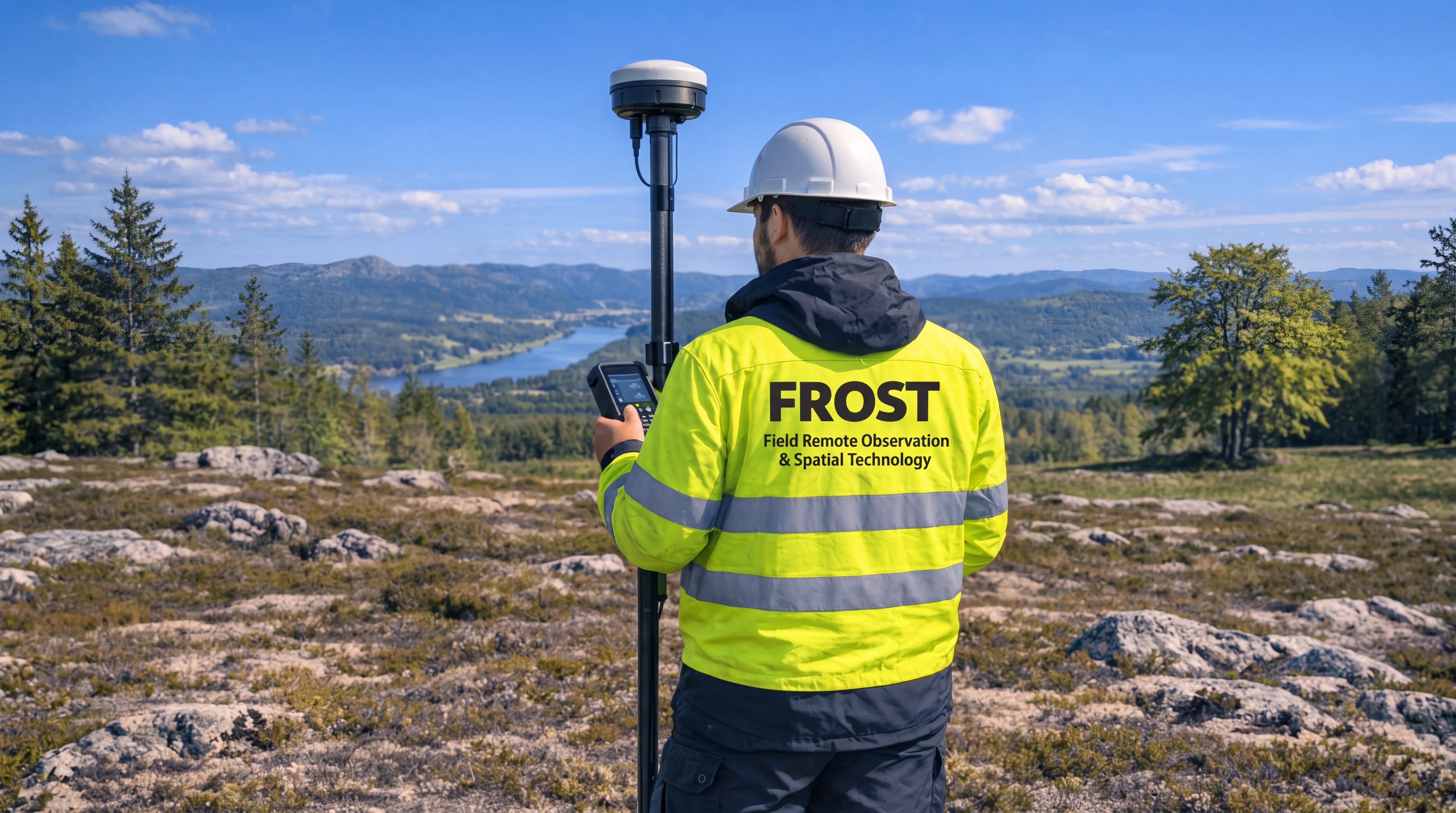
Field Remote Observation & Spatial Technology
High-precision data capture for complex environments
From terrain and infrastructure to shallow water and below the surface.
FROST combines aerial LiDAR, photogrammetry and bathymetric mapping to deliver accurate geospatial data from terrain and infrastructure to shallow water and below the surface.
Accurate datasets for planning, analysis and documentation
Fast deployment with reliable and repeatable
workflows
Mapping terrain, shorelines, shallow water and submerged environments.

High-precision data capture using drone-based sensors — delivering reliable datasets for planning, analysis, and documentation across land and water environments.
Accurate surveying and geospatial data for planning, engineering, construction, and infrastructure projects.
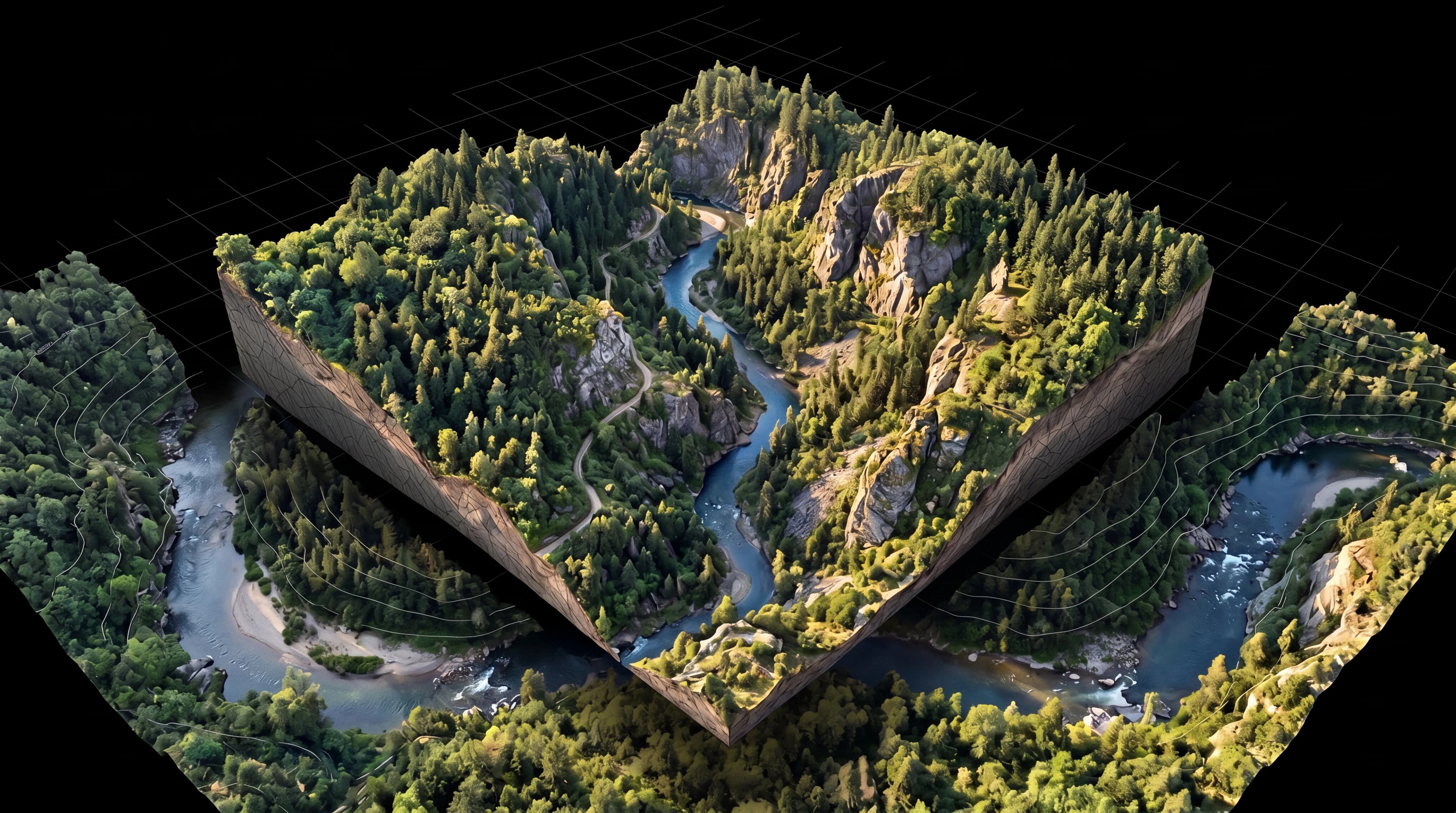
Accurate digital representations for analysis, planning, engineering, and decision-making.
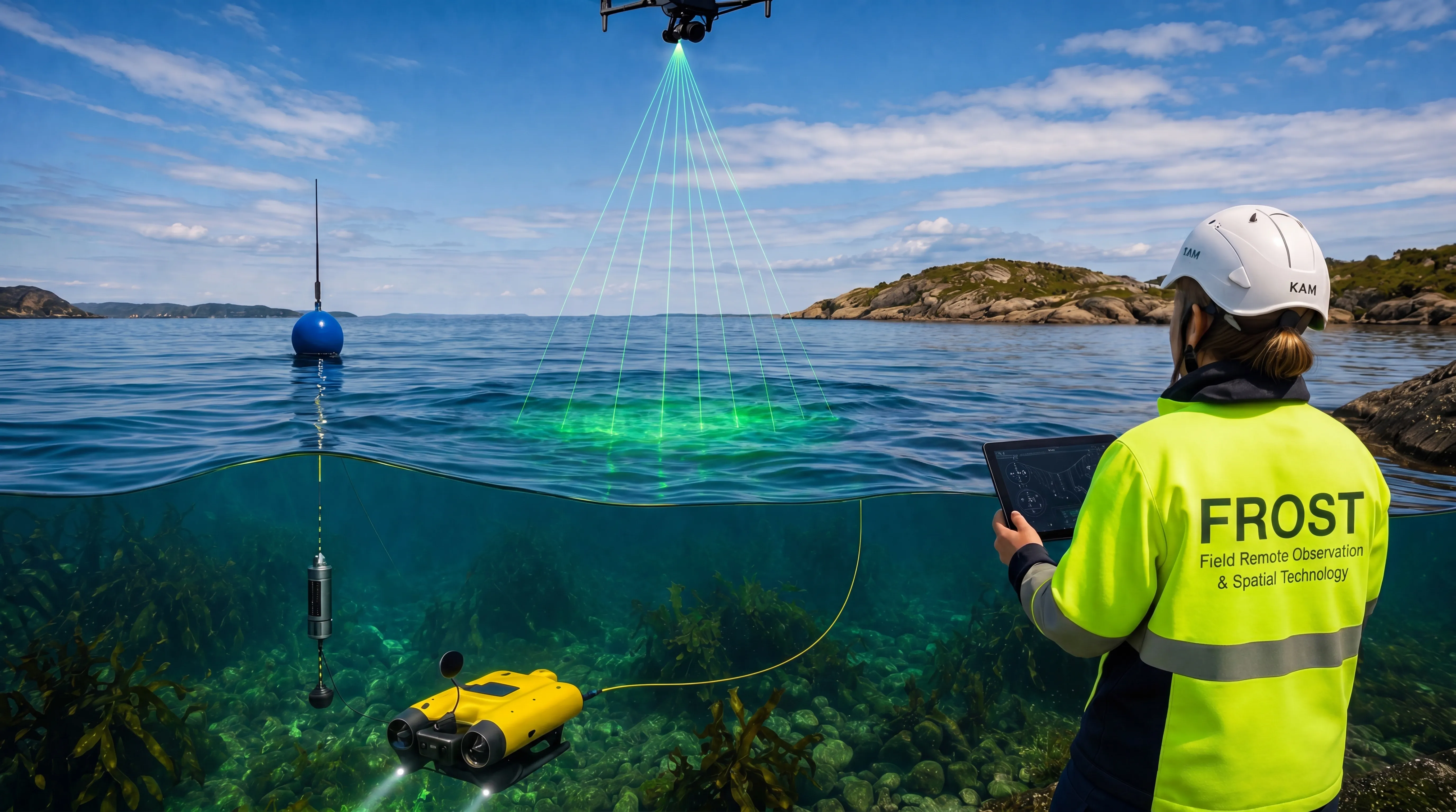
Reliable environmental and aquatic mapping data for planning, monitoring, and long-term management.
FROST combines drone-based LiDAR, photogrammetry, bathymetric mapping and underwater documentation to deliver accurate geospatial data across terrain, infrastructure, shallow water and aquatic environments.
From field data capture to processed datasets, we provide reliable decision support for planning, construction, environmental monitoring and hard-to-access areas.
We deliver high-precision spatial data that supports better planning, faster workflows, and more confident decision-making across complex environments.
Get in touch